CASE STUDY
CalFire Trail Map
Overview
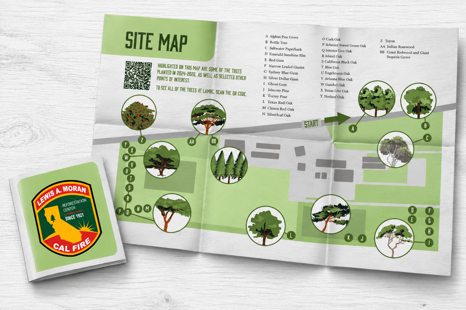
After launching a demonstration forest at the L.A. Moran Reforestation Center in Davis, California, CAL FIRE needed a trail map to guide visitors through its self-guided walking tour. The map would help visitors navigate the site while providing an opportunity to learn more about the trees and the center’s reforestation work.
CAL FIRE partnered with the Design Studio at Sacramento City College to develop the map. Over several months, I worked alongside a team of designers through a multi-phase design process, developing my own design concept and exploring ways to combine practical wayfinding with engaging visual storytelling.
The Challenge: The challenge was to create a map that was both functional and educational. Visitors needed to understand the trail layout and navigate the forest independently, while the design needed to make the experience approachable and encourage exploration.
Research & Exploration: The project began with research and exploration to better understand the site's purpose and the needs of its visitors. From there, I moved into sketching and concept development, considering how to organize the map's information and establish a visual hierarchy that would support an intuitive walking-tour experience.
Design Development: The design process progressed through sketches, design development, and revisions, allowing me to refine the composition and consider how the map's navigational and illustrative elements could work together. The broader project also included a printed brochure or handout to support the visitor experience.
Solution: My design approach combined functional map design with illustrative elements that added an educational dimension. A key feature of my concept was a series of original illustrations depicting different tree species, presented as insets within the map.
The team presented the final map in spring 2026. The project remains ongoing, with plans for a revised map as the demonstration forest expands.
Reflection: This project allowed me to explore how illustration can enhance functional design. The tree-species insets became a defining feature of my concept, creating a visual connection between the map and the living landscape it represents. It also strengthened my understanding of collaborative design, iterative development, and the importance of balancing clear communication with opportunities for visual discovery. The project demonstrates my interest in creating thoughtful, human-centered design that serves a practical purpose while making information more engaging.